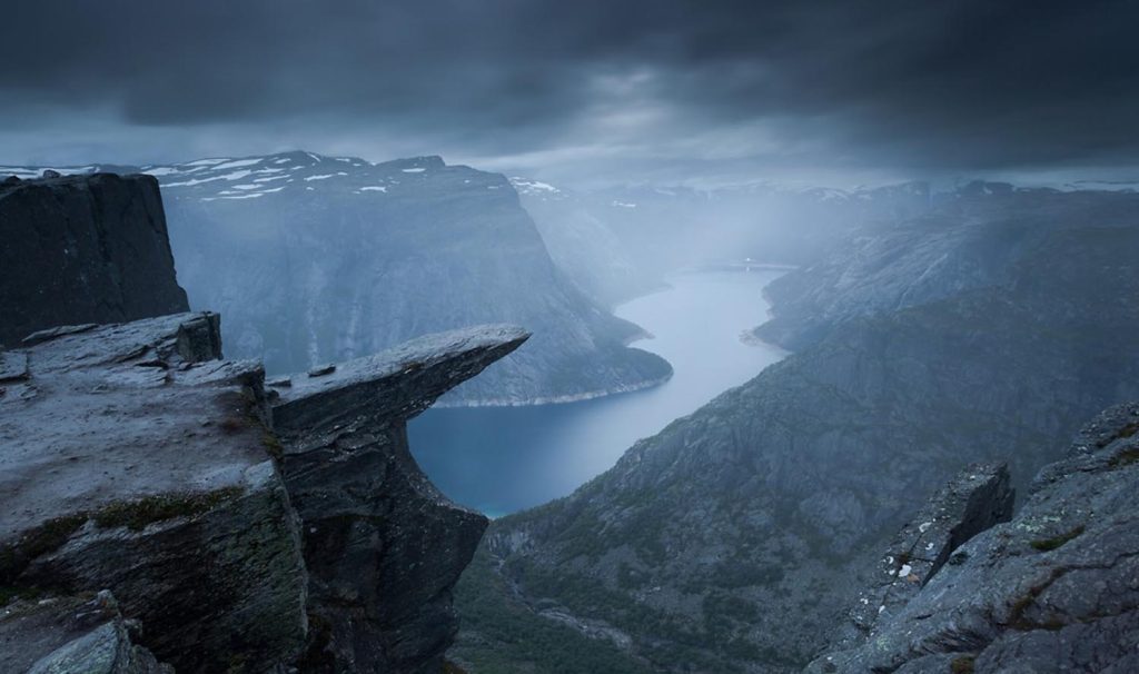
Norway is the ideal destination for many hikers, particularly those looking for solo hikes to places like Trolltunga Norway. The Rocky Mountains and stunning landscapes entice hikers from all over the world to experience the wonderful landscapes and fresh air that the country has to offer each year. Solo hiking to Trolltunga Norway is an amazing experience that allows people to connect with nature on a deeper level while taking on the challenge of this iconic along the way.
This is one of my most memorable solo hiking expeditions, at least in terms of walks. A whole day is required to complete the Trolltunga Norway hike, which involves climbing muddy hills, trekking steep terrain, crossing snowfields, and walking along cliff edges.
The greatest reward is located at the end of the journey. Troll’s Tongue! It takes a few hours to drive from Bergen to the Trolltunga hike in southwest Norway. It is challenging, long, and breathtaking. It’s among the best ways to enjoy the breathtaking surroundings of this country.
I’ll go over some of the details of this hike in a moment because they can be a little confusing. It’s not overly busy, which is one of its great features. Although there will be a lot of people on the track, it is not a typical tourist destination.
As a result, there may not be as much information available as you would like, and it may be challenging to determine a few details in advance. Therefore, I would love to share with you what I discovered during my trip to Trolltunga Norway.
Table of Contents
Where is the Trolltunga Norway Located?
Trolltunga Norway is situated 1180 meters above sea level to the east of Tyssedal. Odda would be the closest town to use as a base before or after your hike. Once in Odda, you must travel to Tyssedal (Route 13) and then ascend to Skjeggedal, a mountain village. From there, you will be traveling down a winding road until you arrive at the parking lot, where your solo hike begins.
Weather in Trolltunga Norway
The weather in Trolltunga Norway can change quickly, even if your solo hiking excursion begins in the sun. Keep in mind that the wind and rain may be more fierce because you will be located quite high up in the mountains. The Trolltunga hike takes at least eight hours, so be sure you are prepared for any of these situations before beginning.
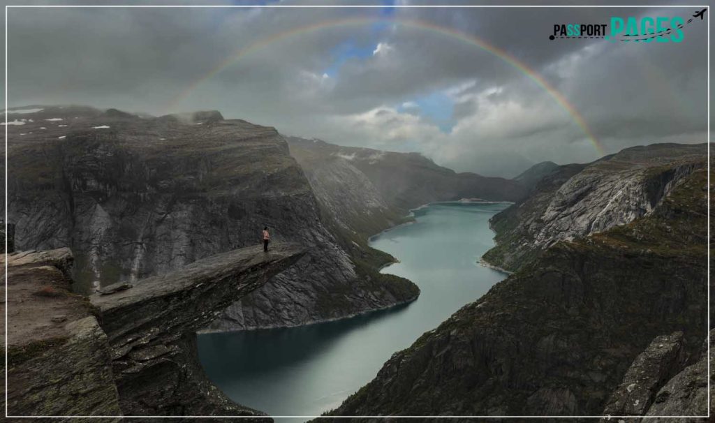
I had milder weather at the beginning of our solo hiking trip in Trolltunga Norway, and colder weather at the summit. By the time we began the journey home, clouds and dense fog had moved in, and rain had begun. On the way down, we experienced heavy rain for nearly an hour.
Best time to visit Trolltunga Norway
This far up in the mountains, summer and winter are the only two seasons.
The summer solo hiking season in Trolltunga Norway runs from June to August. If you feel comfortable doing so, the weather between these dates will typically be suitable for solo hiking without a guide.
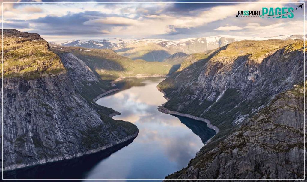
During the Trolltunga winter season, which runs from October through April, you might want to avoid trekking without a guide. This is because there may be severe weather, and there aren’t as many hikers to set the pace.
As “shoulder seasons,” September and May can have either a warm or cold climate. Before going on a hike, be sure to check the weather forecast.
Hike Details
Duration: Around 8 to 12 hours.
Distance: Approximately 23 kilometers.
Difficulty Level: Hard especially for inexperienced hikers, and moderate for experienced hikers.
Ascent: 1000 Meters.
Height above sea level: 1100 Meters.
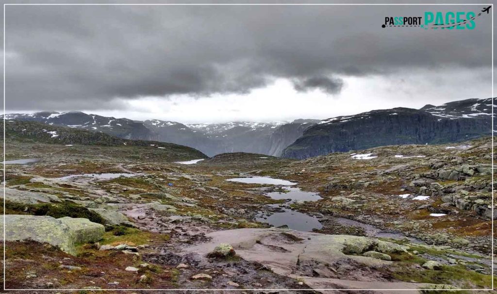
Surface: Primarily rocky with some spots of greenery and snow.
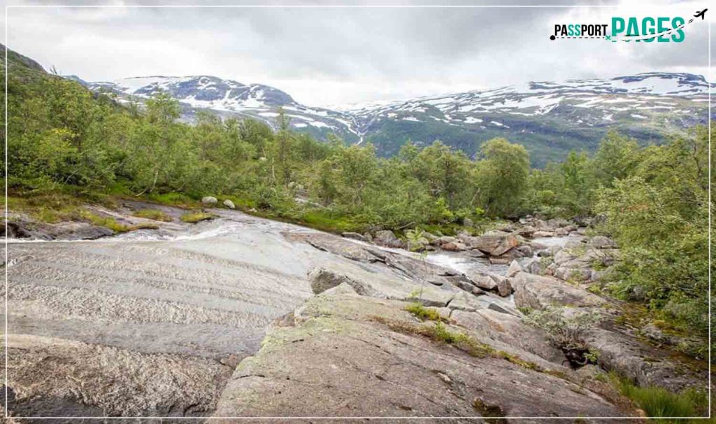
Trail: Simply follow the cairns or rocks with large red letters that spell out “T.” There are enough signs and hikers scattered throughout the trail that you may use as a “guide” to follow, especially now that the trek is so well-liked by visitors.
Getting to Trolltunga Norway Hiking Trail
One of my favorite solo hiking routes was the Trolltunga Norway trip. It’s not simple to get to the trailhead, and I really found it to be more difficult than the walk itself!
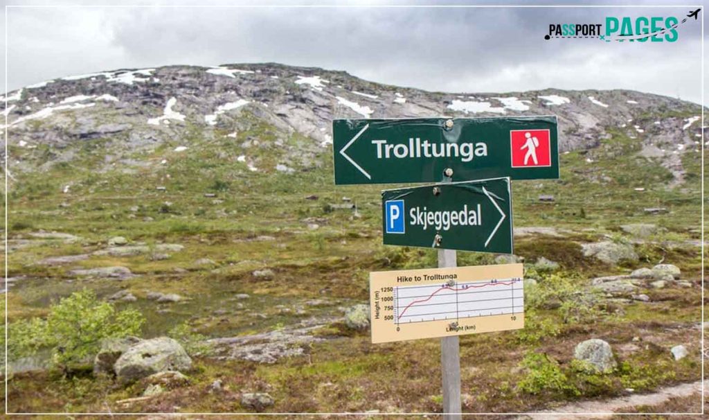
Driving is the simplest method. You must travel to Skjeggedal, a tiny town 17 kilometers outside of Odda and 190 kilometers from Bergen. The final 7 kilometers from the closest town, Tyssedal, to Skjeggedal, are on a steep, narrow mountain route where you might need to stop to let other vehicles pass.
Public transportation is difficult and limited. Therefore, if at all possible, I strongly advise renting a car from either Bergen or Voss and making the trip to Skjeggedal. However, you must first travel to the town of Odda if you plan to travel there via public transportation. You can then take bus route 995 to Tyssedal from there. Getting the final stretch to Skjeggedal is the challenging part.
Trolltunga Norway Hiking Route: My Own Experience
The trailhead for the Trolltunga trek is located in Skjeggedal’s main parking lot, and it is well-marked. Although you can still see the remains of the funicular that once traveled up this hill, it is no longer in use and it is unsafe to ascend the aging wooden structure.
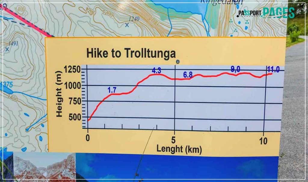
You’ll have to walk down a muddy, steep route that can be treacherous after recent rain. You can use the ropes to aid in the climb. But don’t worry; it gets a little simpler after this. The distance is 23 kilometers round trip or 11.5 kilometers in each direction. The track heading to Trolltunga is hilly and will take longer than coming back. I took 8 hours to complete the walk: 4 hours to travel there, 1 hour to reach the rock, and 3 hours to return.
The route is clearly identified each step of the way. Signposts that both orient you in the right way and indicate how far you have already gone are present. To keep on the right path, you should walk between any small heaps of boulders that are present in locations where the way is not entirely clear.
Uphill to Maglitopp
You should be prepared for this ascent since it can become quite exhausting and difficult! The first section was a steep track that was roughly at an inclination of 50 degrees.
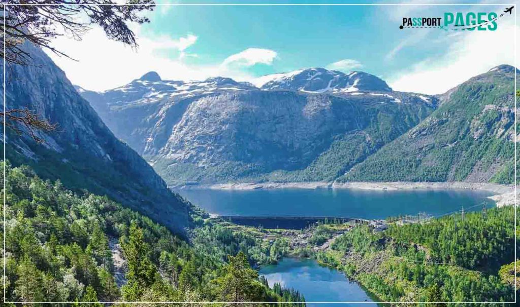
For your safety, there are stone steps and ropes along the way. As you climb higher, you’ll start to get a wonderful view over the dam that maintains the Ringedalsvatnet lake.
Trombaskaret
After a little break, we resumed our journey, climbing another 330 meters or so, until we reached Trombaskaret, the highest point on the trail’s first half. After a little break, we resumed our journey, climbing another 330 meters or so, until we reached Trombaskaret, the highest point on the trail’s first half.
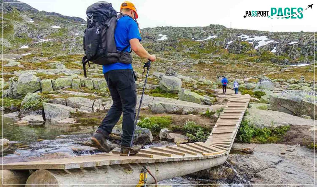
There were also areas of the trail where melting snow would cross, but thankfully there were little wooden bridges installed to aid hikers in getting across.
Store Floren
After passing Trombaskaret, the path slopes downward toward Store Floren, providing a much-needed break from the steep trek we had just completed.
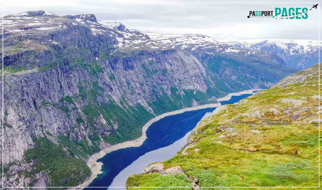
A beautiful view of the descent towards the valley floor, where the lake of Ringedalsvatnet is located, made this yet another gorgeous location. But it didn’t stop there; it also provided us with a view of the Folgefonna glacier in the west!
Endanuten
The trail continues over Hesteflaene and to the dried-up river of Endano, which is close to the drought waterfall Tyssestrengene—a twin waterfall that once stood 300 meters tall. The walk is a mixture of modest uphill and downhill slopes.
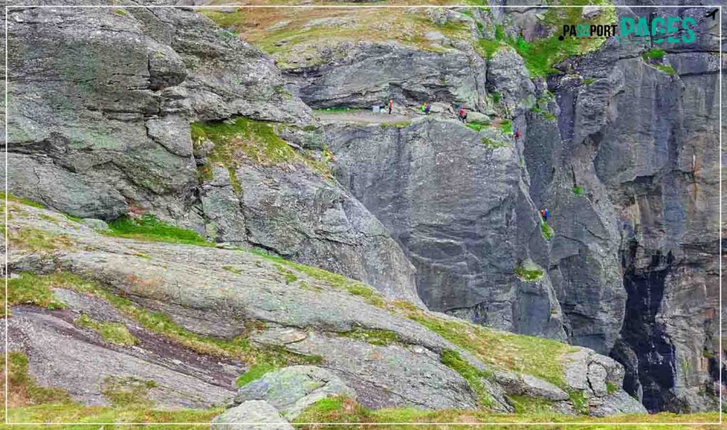
In addition, we began to notice glacial potholes dotting the terrain, which gave the rocks fascinating features. We carried on traveling until, out of the blue, and got close to Trolltunga Norway.
Finally Trolltunga Norway
It was truly fantastic beyond words!
Additionally terrifying was watching the crowd approach the tongue tip one by one.
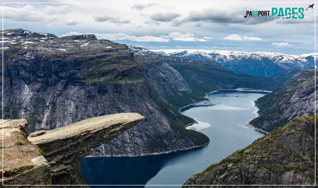
I couldn’t help but feel butterflies in my stomach as I looked at it all. In fact, there were moments when I couldn’t bear to watch someone perform a “jump shot” or sit on a ledge because I had horrifying thoughts that they might fall — although, of course, I wish they wouldn’t!
Yes, the area around Trolltunga has picturesque, mountainous areas that would look great on Instagram. Take your time exploring these areas.
Solo Hiking Equipment for the Trolltunga Norway
The trail doesn’t have a particularly challenging rise in terms of equipment needed for hiking. Mostly, it’s just a long trek through mud, little streams, and unpredictable weather.
You should include the following items as a bare minimum:
- Headlamp
- Plenty of food and water
- First aid kit
- Waterproof hiking boots
- Thick hiking socks
- Warm top layer
- Waterproof and windproof jacket
- Gloves
- Extra set of clothing and socks
- Sunglasses and sun protection
- Reusable water bottle
- Light comfortable backpack
- Hiking sticks
- Camera
Safety While Hiking Trolltunga Norway
Although there isn’t much infrastructure along the route, this solo hike is generally pretty safe, so use caution. Because there is too much snow the rest of the year, you can only truly complete the walk easily between June and September. Avoid doing the trek outside of those months at all costs.
The weather, which I’ve already touched on, is the largest threat to safety. Be ready since it can suddenly get quite chilly and rainy. You must also be careful where you walk because there are several areas where the track is uneven and runs alongside mountains. For certain areas, it would be a good idea to wear sturdy footwear and have a walking stick.
Overall though, everything should go smoothly provided you are ready for the hike. It is among the most amazing hiking experiences available in Europe. The sights at the finish are stunning, and the route takes you through some amazing scenery. Just keep in mind two things if you decide to go yourself: enjoy yourself, and don’t forget your camera!
The Way Back
I must admit that the ascent did not put me under as much pressure. Even though it was easier on my legs, it was nonetheless exhausting. But I did not anticipate that the ascent down Trolltunga would wear me out.
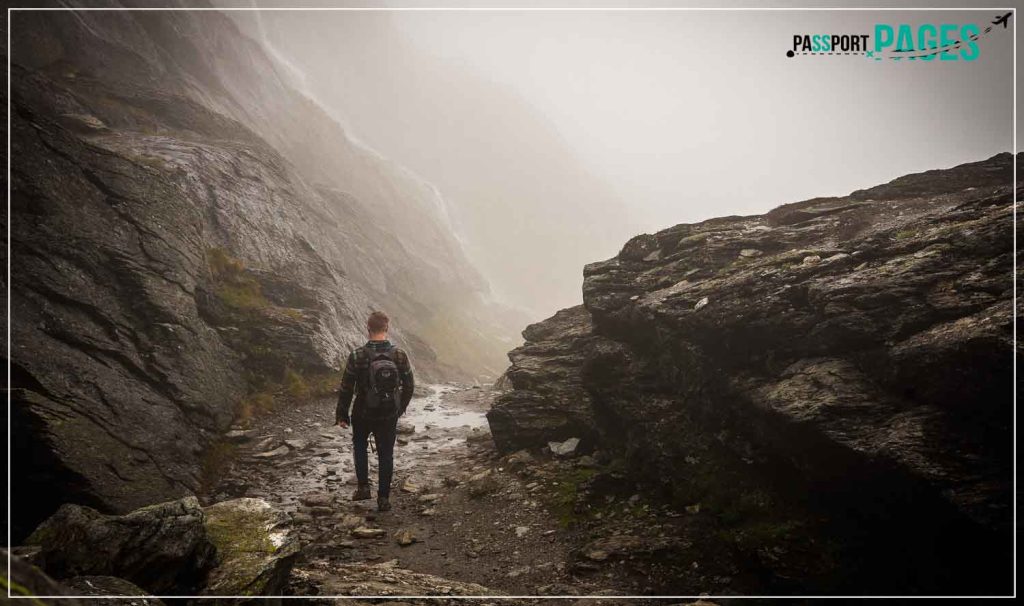
Obviously, as we began our descent, we were moving much more quickly than while we were ascending. However, it gradually turned into an extreme hike for me when it started to rain halfway back!
First of all, the ground was muddy, which made my steps more difficult. Second, the stones started to become slick, so we had to pay close attention to our steps at ALL times to prevent falling and breaking any bones. Since Maglitopp had the steepest slope, this is also where it took us the longest to begin our descent.
Final Thoughts!
In conclusion, Trolltunga Norway is an incredibly amazing location for both adventurers and nature lovers. For those ready to take on the challenge, this famous location offers a demanding and rewarding solo hiking experience amidst breathtaking surroundings.
The weather in the mountains can be erratic, so it’s important to be ready for sudden changes. Despite the potential difficulties, reaching the Troll’s Tongue at the trail’s finish is a really fulfilling accomplishment that fosters a strong connection with Norway’s natural beauty.
If you have any further queries on the solo hiking to Trolltunga Norway, post them in the comments section below. I’d be interested in hearing from you if you recently hiked to Trolltunga Norway. Enjoy your hike!
FAQs
Are drones allowed at Trolltunga to take photos and videos?
The usage of drones is permitted at Trolltunga, which is good news. You should check the website of the Civil Aviation Authority of Norway for information about drone regulations and safety in Norway.
What are some interesting facts about Trolltunga?
The Norwegian word “Trolltunga” literally translates to “the troll’s tongue.” A Scandinavian ice sheet during the ice age formed this cliff and the valley below. Trolltunga is situated 700 meters above Lake Ringedalsvatnet and 1,100 meters above sea level.
Can you camp on Trolltunga?
Thankfully, there are fantastic alternatives to carrying all that camping equipment! An overnight stay and guided walk are both available from Trolltunga Active.

